Forbidden City
Interactive map
GPS track profile
About this GPS track
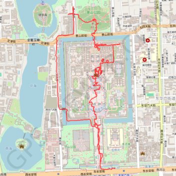
Name: Forbidden City GPS track, route, trail
End: 东长安街, 东华门街道, 首都功能核心区, Dongcheng, Pékin, 100010, Chine (39.90662 116.39360)
Coordinates: 39.90650 116.38483 39.92508 116.39436
Name: Forbidden City GPS track, route, trail
End: 东长安街, 东华门街道, 首都功能核心区, Dongcheng, Pékin, 100010, Chine (39.90662 116.39360)
Coordinates: 39.90650 116.38483 39.92508 116.39436