Laguna Grande - Alto de Garajonay - Laguna Grande
Interactive map
GPS track profile
About this GPS track
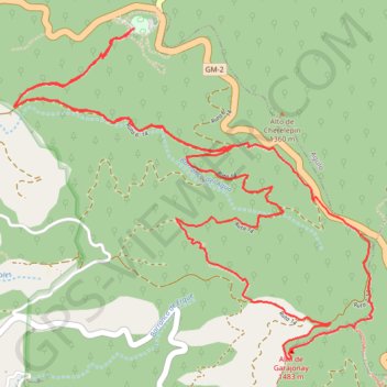
Name: Laguna Grande - Alto de Garajonay - Laguna Grande GPS track, route, trail
Coordinates: 28.10931 -17.26460 28.12646 -17.24355
Name: Laguna Grande - Alto de Garajonay - Laguna Grande GPS track, route, trail
Coordinates: 28.10931 -17.26460 28.12646 -17.24355