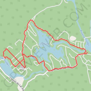
Lac Clair
Randonnée en boucle depuis Chertsey. #Randonnée #Boucle
- Distance: 7.8 Km
- Elevation gain: 120 m
- Maximum elevation: 281 m
- Elevation loss: 118 m
- Minimum elevation: 231 m
- Moving time: 2 h 18 m
- Moving speed: 3.4 Km/h
- Maximum speed: 12.5 Km/h
- Total time: 2 h 20 m
- Global speed: 3.3 Km/h
- Date: Friday, October 12, 2012
Interactive map
GPS track profile
About this GPS track
Name: Lac Clair GPS track, route, trail
Start: 4806, Chemin du Lac-Brûlé, Chertsey, Matawinie, Lanaudière, Québec, Canada (46.11499 -73.80305)
End: 4812, Chemin du Lac-Brûlé, Chertsey, Matawinie, Lanaudière, Québec, Canada (46.11478 -73.80328)
Coordinates: 46.11063 -73.83157 46.12263 -73.80305
Other GPS tracks
Click on a GPS track to view route, its statistics and profile.