Hong_Kong
- Distance: 117.7 Km
- Elevation gain: 2,773 m
- Maximum elevation: 99 m
- Elevation loss: 2,770 m
- Minimum elevation: -7 m
Interactive map
GPS track profile
About this GPS track
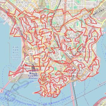
Name: Hong_Kong GPS track, route, trail
Coordinates: 22.29276 114.15254 22.32809 114.19423
Topography: Kowloon topographic map
Other GPS tracks
Click on a GPS track to view route, its statistics and profile.
Wilson Trail Full Route
China > Hong Kong > Hong Kong Island
Distance: 81.2 Km • Elevation gain: 4,430 m • Maximum elevation: 613 m