Anaga : Chamorga - Faro de Anago
- Distance: 7.7 Km
- Elevation gain: 657 m
- Maximum elevation: 612 m
- Elevation loss: 655 m
- Minimum elevation: 66 m
Interactive map
GPS track profile
About this GPS track
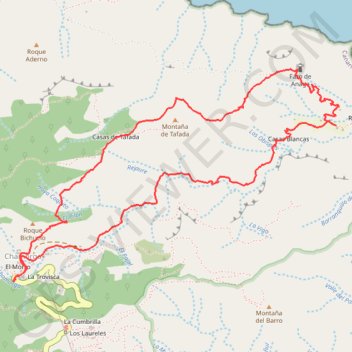
Name: Anaga : Chamorga - Faro de Anago GPS track, route, trail
Coordinates: 28.56833 -16.15972 28.58122 -16.13735
Other GPS tracks
Click on a GPS track to view route, its statistics and profile.
Faro de Anaga
Espagne > Santa Cruz de Ténérife
Benijo - Roque Bermejo. #Randonnée
Distance: 7.1 Km • Elevation gain: 674 m • Maximum elevation: 309 m