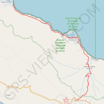
Faja dos cubres
Randonnée pédestre. En aller simple. #Randonnée
- Distance: 9.0 Km
- Elevation gain: 294 m
- Maximum elevation: 694 m
- Elevation loss: 970 m
- Minimum elevation: 1 m
- Moving time: 2 h 45 m
- Moving speed: 3.3 Km/h
- Maximum speed: 6.1 Km/h
- Total time: 5 h 30 m
- Global speed: 1.6 Km/h
- Date: Tuesday, July 20, 2010
Interactive map
GPS track profile
About this GPS track
Name: Faja dos cubres GPS track, route, trail
Start: ER 2-2, Ribeira Seca, Calheta, Açores, 9850-213, Portugal (38.59747 -27.92659)
End: Fajã dos Cubres, Ribeira Seca, Calheta, Açores, 9850-213, Portugal (38.64014 -27.96300)
Coordinates: 38.59747 -27.96315 38.64014 -27.91881