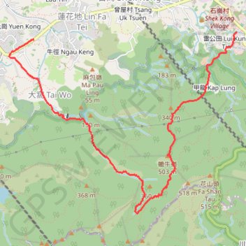
甲龍右 清潭
- Distance: 8.5 Km
- Elevation gain: 431 m
- Maximum elevation: 477 m
- Elevation loss: 506 m
- Minimum elevation: 17 m
- Moving time: 3 h 11 m
- Moving speed: 2.7 Km/h
- Maximum speed: 14.2 Km/h
- Total time: 7 h 34 m
- Global speed: 1.1 Km/h
- Date: Sunday, March 03, 2024
Interactive map
GPS track profile
About this GPS track
Name: 甲龍右 清潭 GPS track, route, trail
Coordinates: 22.40397 114.07686 22.42669 114.10773
Topography: Yuen Long District topographic map
Other GPS tracks
Click on a GPS track to view route, its statistics and profile.
2024 4TUL Half Loop Final
China > Hong Kong > Tsuen Wan District > Chuen Lung Village > Chuen Lung Cha Tau Wo
Distance: 89.0 Km • Elevation gain: 2,267 m • Maximum elevation: 535 m