21KM
- Distance: 21.2 Km
- Elevation gain: 234 m
- Maximum elevation: 520 m
- Elevation loss: 234 m
- Minimum elevation: 440 m
Interactive map
GPS track profile
About this GPS track
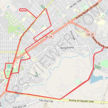
Name: 21KM GPS track, route, trail
Coordinates: 12.66646 108.04087 12.69712 108.07548
Topography: Buôn Ma Thuột topographic map