鬼氹
Outdoor hiking
- Distance: 5.9 Km
- Elevation gain: 297 m
- Maximum elevation: 108 m
- Elevation loss: 279 m
- Minimum elevation: 0 m
- Moving time: 1 h 53 m
- Moving speed: 3.1 Km/h
- Maximum speed: 10.3 Km/h
- Total time: 3 h 11 m
- Global speed: 1.9 Km/h
- Date: Sunday, May 05, 2024
Interactive map
GPS track profile
About this GPS track
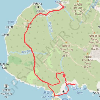
Name: 鬼氹 GPS track, route, trail
Coordinates: 22.24118 114.28359 22.25468 114.29165
Topography: Sai Kung District topographic map