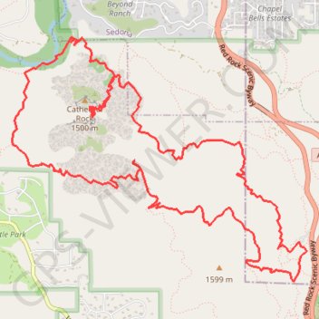
Cathedral Rock Loop
Loop hike to Cathedral Rock Viewpoint via Slim Shady Trail, Templeton Trail, Cathedral Rock Trail, Oak Creek, Baldwin Trail, Hiline Trail and Yavapai Vista in the Coconino National Forest. #Hike #Loop #Rock #Nature #Forest #River #Mountain
- Distance: 14.4 Km
- Elevation gain: 684 m
- Maximum elevation: 1,472 m
- Elevation loss: 684 m
- Minimum elevation: 1,218 m
- Moving time: 5 h 21 m
- Moving speed: 2.7 Km/h
- Maximum speed: 11.0 Km/h
- Total time: 7 h 8 m
- Global speed: 2.0 Km/h
- Date: Saturday, September 15, 2018
Interactive map
GPS track profile
About this GPS track
Name: Cathedral Rock Loop GPS track, route, trail
Coordinates: 34.80372 -111.80115 34.82563 -111.76893
Other GPS tracks
Click on a GPS track to view route, its statistics and profile.